![]()
|
|
| WMATA: Dulles Corridor Metrorail Project VDOT Aerial photos (1179762) | |
|
|
|
| Home > SubChat | |
[ Post a New Response | Return to the Index ]
| (1179762) | |
WMATA: Dulles Corridor Metrorail Project VDOT Aerial photos |
|
|
Posted by Sand Box John on Thu Oct 4 00:01:01 2012 From VDoT flicker photo stream Aerials in NOVA August-22-2012.Pictures taken couple of weeks after the pictures I took on 09 08 2012 as seen in my DCMP blog post and linked to at WMATA: Dulles Corridor Metrorail Project Pictures 09 08 2012 . All pictures by Trevor Wrayton  VA-7 Leesburg Pike VA-267 Dulles Access / Toll Roads.  VA-7 Leesburg Pike VA-267 Dulles Access / Toll Roads. 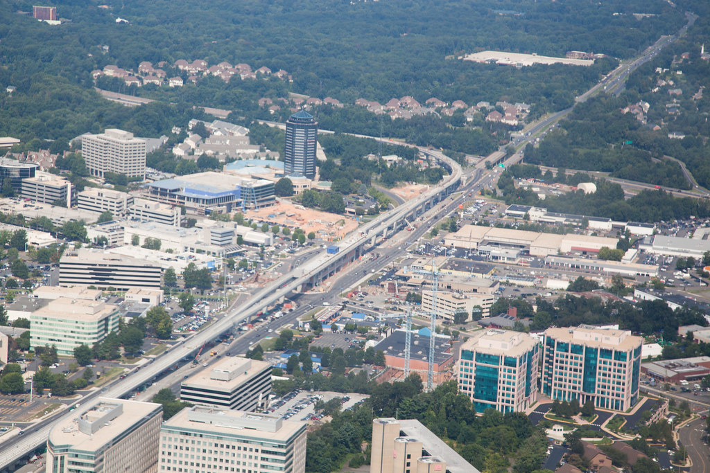 VA-7 Leesburg Pike Spring Hill station. 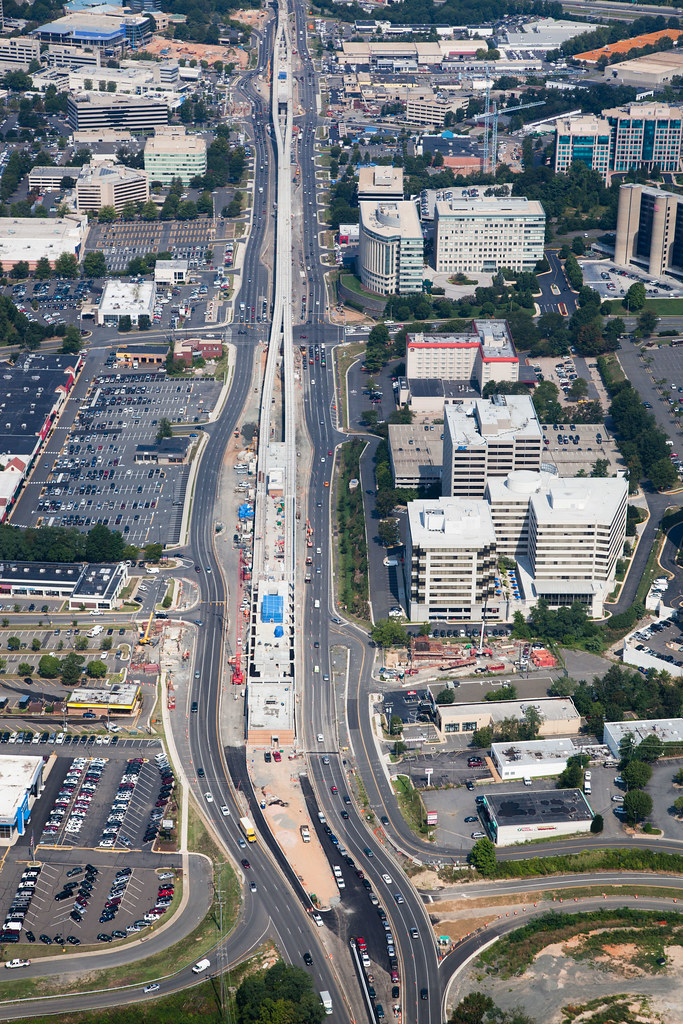 VA-7 Leesburg Pike, Greensboro and Spring Hill stations. 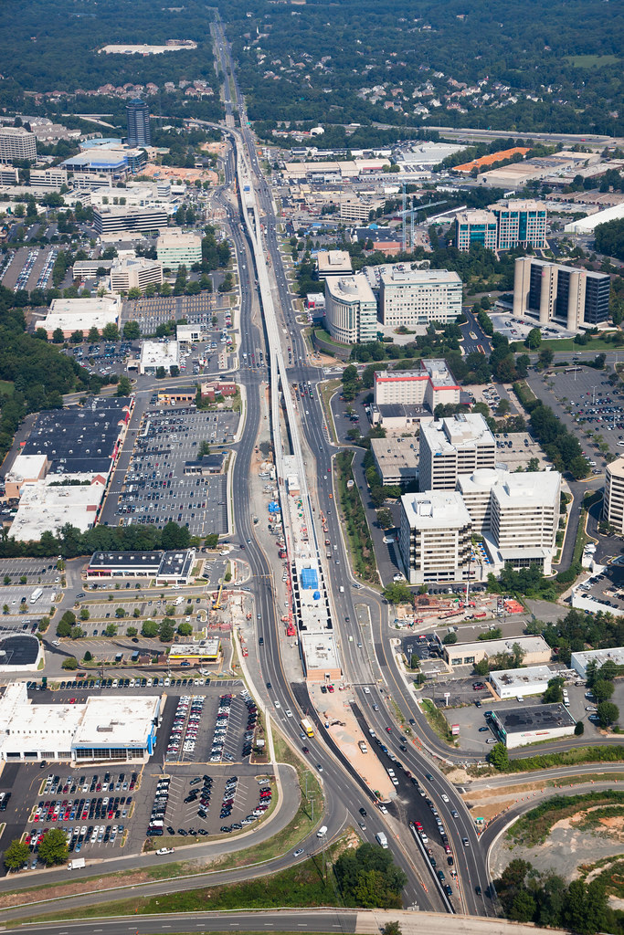 VA-7 Leesburg Pike, Greensboro and Spring Hill stations. 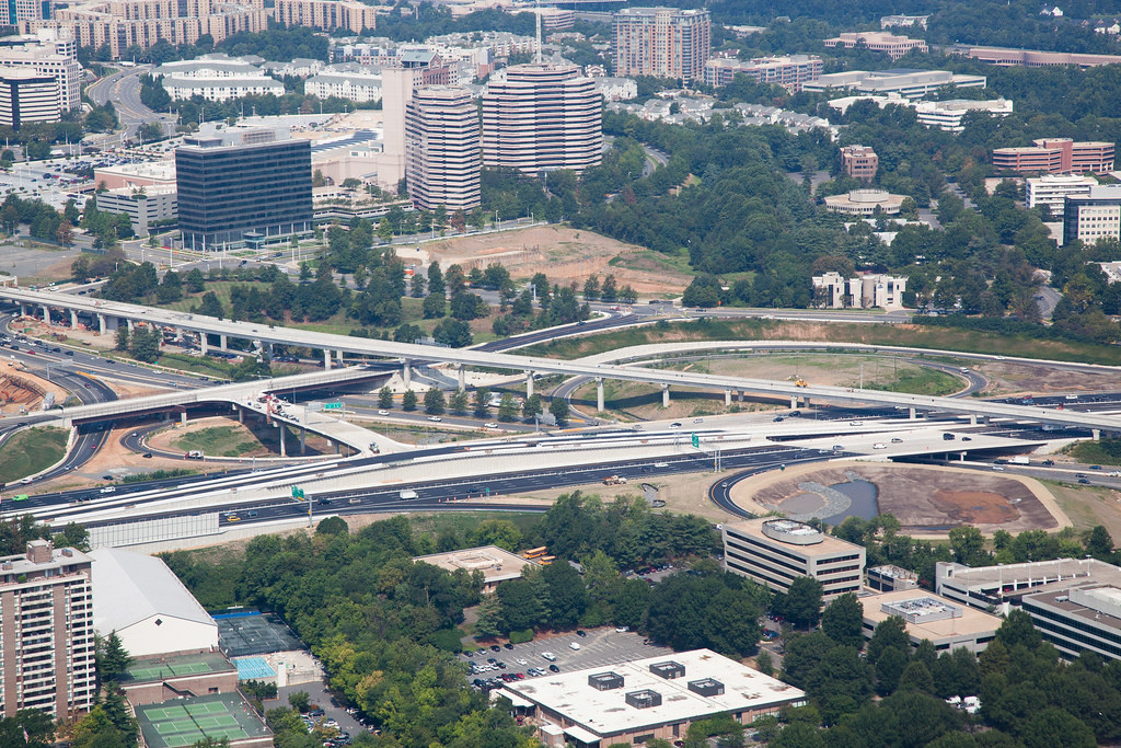 VA-123 Dolley Madison Boulevard VA I-495 Capitol Beltway. 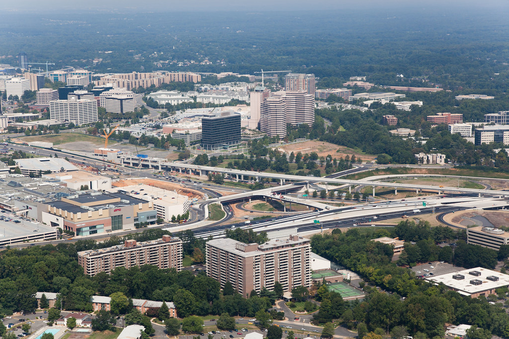 VA-123 Dolley Madison Boulevard VA I-495 Capitol Beltway, Tysons Corner station.  VA-123 Dolley Madison Boulevard VA I-495 Capitol Beltway, Tysons Corner station. 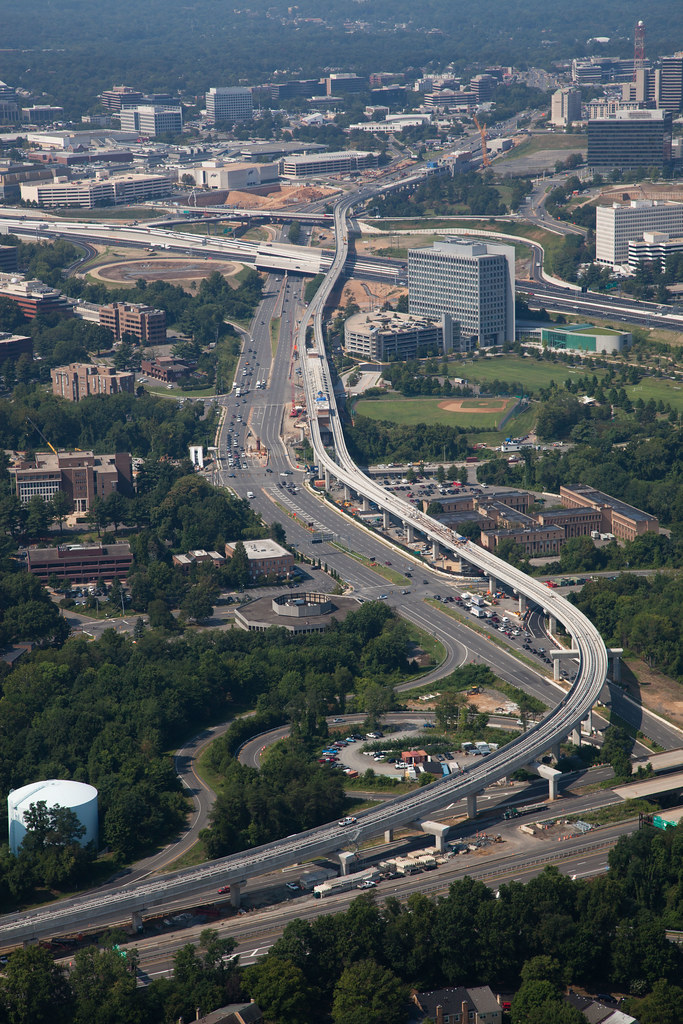 VA-123 Dolley Madison Boulevard VA-267, Tysons McLean station. 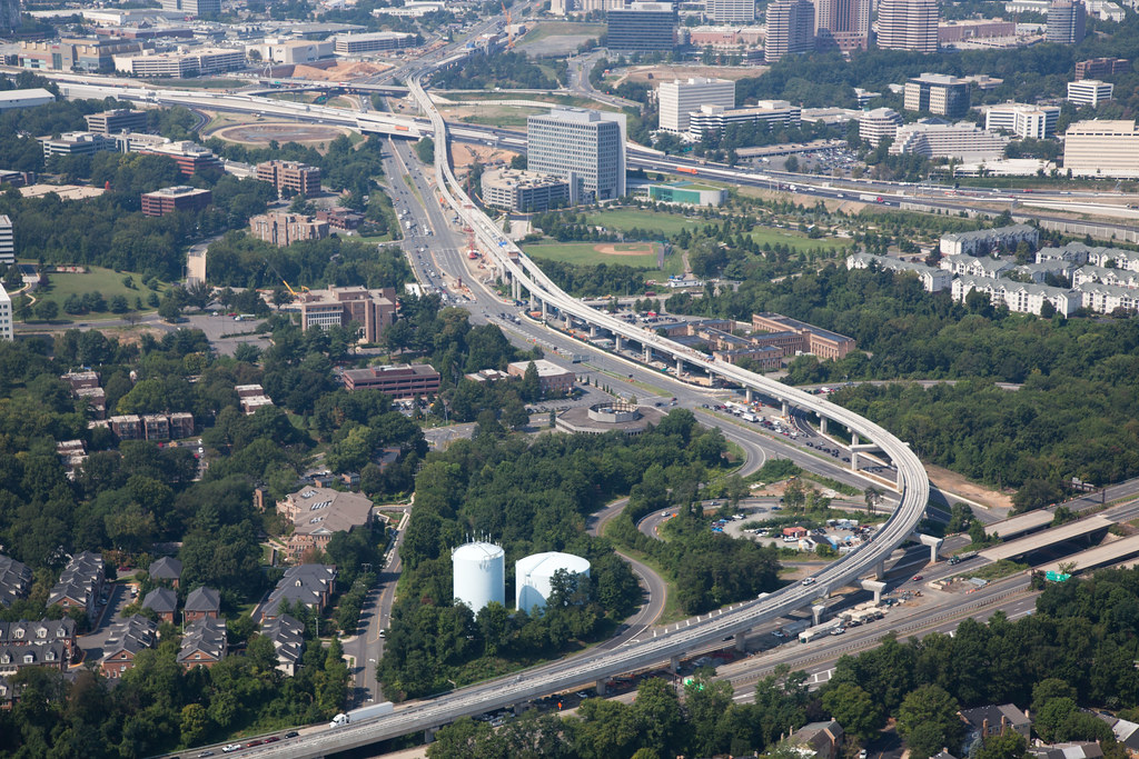 VA-123 Dolley Madison Boulevard VA-267, Tysons McLean station.  VA I-66 VA-267 Dulles Connector Road flyover. 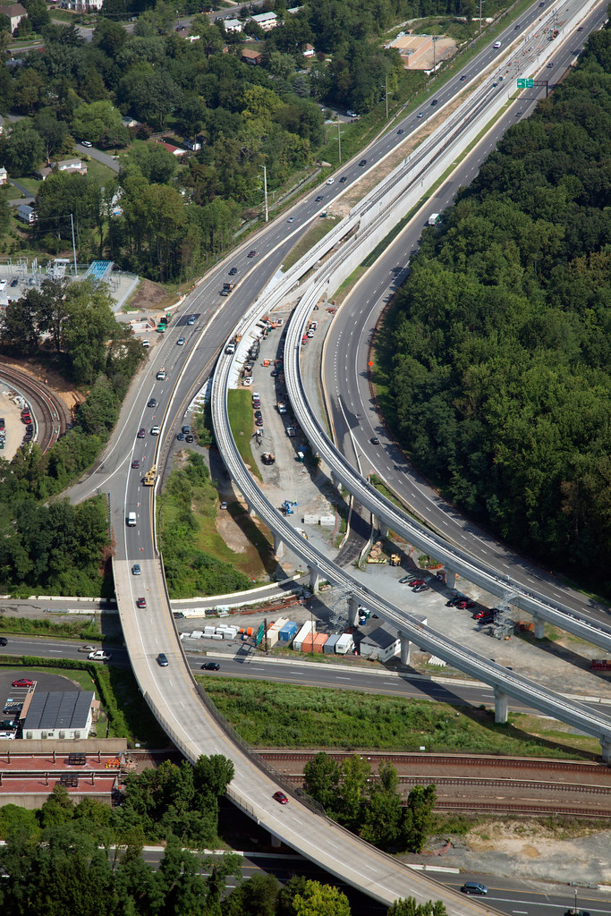 VA I-66 VA-267 Dulles Connector Road flyover. Previous VDoT Aerials can be seen at my DCMP VDoT Aerial Photos blog post John in the sand box of Maryland's eastern shore. |
|
| (1179777) | |
Re: WMATA: Dulles Corridor Metrorail Project VDOT Aerial photos |
|
|
Posted by JohnnyMints on Thu Oct 4 01:55:52 2012, in response to WMATA: Dulles Corridor Metrorail Project VDOT Aerial photos, posted by Sand Box John on Thu Oct 4 00:01:01 2012. Great pics! |
|
